


For the last two years, Europe’s SESAR research project ICARUS has been investigating the problem of establishing a Common Reference Altitude (CAR) system that is suitable for manned and unmanned aviation operating in Very Low-Level airspace (VLL) using U-space services.
The first meeting, held in October 2020, introduced the project and its objectives to the members of the Advisory Board. On June 2021, the second workshop focused on the ICARUS concept and architecture, that had been developed during its first year.
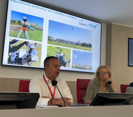
In this last workshop, the partners of ICARUS recapitulated the work performed during the project, with an emphasis on the results of the validation campaigns carried out as well as the main results, conclusions, and recommendations compiled during the project.
ICARUS has established a bridge between two previously unconnected worlds, manned aviation, managed by ATM, and unmanned aviation handled by UTM. In the future, both worlds will interact using the CAR developed by ICARUS.
Discussion about the results
Among the issues raised during the meeting, a selection is included below:
- How will the GA pilots receive the information about nearby drone traffic?
Initially, we thought to use a mobile phone app, but finally we have developed an electronic flight bag (EFB) device. The prototype shows the direction and height difference of drones flying less than 5 NM around the aircraft.
- What is the role of the granularity of DTM/DSM models in the Total Error of the ICARUS CARS?
These errors do not affect the Common Altitude Reference Service (CARS).
The key advantage of CARS is that users can use their preferred altitude estimation system that better suits the needs of their operations. ICARUS will take care of the conversions for the benefit of all users sharing an airspace.
For the Vertical Alert Service (VALS), which is a premium added value service provided by the ICARUS architecture, the accuracy of the DTM/DSM models directly impacts the accuracy of the VALS. To further develop VALS, extensive work has to be carried out to ensure that the underlying terrain models used are adequate.
- Are we considering extending the system for higher altitude environments?
Yes, we are. But we need to take into consideration the increased certification and regulatory requirements.
We should note that the traditional aviation regulatory route is too slow. We should rather aim to base our solution on performance-based regulation, supported by industry standards.
Conclusions and the way forward
A one-sentence summary of the project is: The computation of a common altitude reference is possible, and ICARUS has proved it. Full implementation will require additional technological and legislative/regulatory support.
In that respect, key future R&D needs are:
- Certification methods and standards for UAS static pressure sensor calibration.
- Plan the network of METEO sensors in rural, low- and high-density urban areas.
- System specific specification to be shared between different providers.
- Investigate and minimise the reduced vertical separation minimum values to increase the capacity of congested airspace.
And on the legislative and regulatory front:
- Definition and role of new regulations defining the services.
- Add the CARA requirements to the SERA.
- National Authority to manage a single DTM/DSM.
- Certification of the altitude reference system used by drones and sensor calibration.
- Modification of the operating procedures for ATS.
- Education and training for manned UAS pilots.
For more information visit:
www.u-spaceicarus.eu