

A GNSS drone survey of Okotoks Air Ranch Airport, Canada, was carried out by drone operator IN-FLIGHT Data using senseFly’s fixed-wing drone and geomatics specialist Benchmark Geomatics. The daytime flight took place above people while manned aircraft were taking off, landing, and entering the aerodrome circuit. There were no NOTAM’s filed, and there were no runways closed, as part of the operation.
This high-accuracy survey was conducted as the busy suburban airport performs multiple surveys and assessments to prepare for possible future construction and expansion plans. This was the first time this type of advanced drone operation at an airport has been permitted in Canada under the Part 9 regulations.
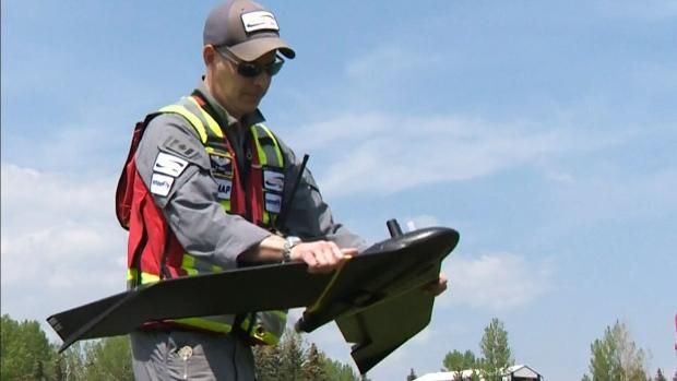
The Remotely Piloted Aircraft System (RPAS), used high-resolution aerial payloads and highly-accurate survey technologies to produce a very accurate 3D model of the entire residential community and airport property so that future construction professionals can assess plans and designs. The aircraft used for the survey was the eBee Plus, one of only a handful of fixed-wing aircraft certified for Operations-Over-People in Canada. The payload used for the survey was the senseFly S.O.D.A with 1-inch CMOS sensor.
The senseFly eBee Plus meets Transport Canada’s standards for drone aircraft certified for flights over people, and in controlled airspace. The RPAS was equipped with eMotion flight planning software, integrated airspace intelligence and uAvionix ADS-B transponder to support safe operations within the boundaries of Part 9 Canadian Aviation Regulations.
(Image: IN FLIGHT Data)
For more information visit:
