


Air Traffic Control the Netherlands (LVNL) has introduced two significant upgrades for drone operators. These upgrades include creating an account in the (web)app and the ability for certified drone operators to submit an application, and receive permission, to fly in controlled airspace (CTR) via the Altitude Angel powered GoDrone app and website.
With the new feature, LVNL is making the process for this kind of applications, which until now was conducted via telephone or e-mail, quicker and more efficient.
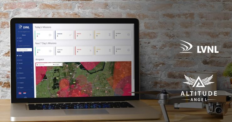
By creating an account, the user gains access to the GoDrone Operator Portal. This portal is a pre-flight planning tool which provides information about the airspace and obstacles on the ground. It helps the operator to carefully prepare their mission, conduct the drone flight safely and efficiently, and comply with applicable laws and regulations.
In addition, certified drone operators can create a profile for their company in the app. This makes it possible to add other users to this organisation and assign them a role, such as ‘drone operator’ or ‘observer’.
Planning and obtaining preliminary permission for a drone flight in a CTR involves submitting a mission plan via the app or web version. The submitted mission plan is then assessed by LVNL. The submitter of the mission plan will be kept informed of the progress of the assessment via SMS and e-mail. Currently, users can file their request 24 hours in advance.
In the case of a positive assessment, the applicant will be given provisional authorisation.
Crucially, the areas for which an operator has submitted a mission are also visible to all other users in GoDrone. This information will eventually also be used to inform manned aviation (such as low-flying emergency helicopters) about planned and actual drone flights, building a layer of safety into the airspace which was not there previously.
Since the launch in April 2020, several updates to the operating system of the GoDrone app have been made. Examples include improving the visibility of the subsurface/map in the case of multiple overlapping restricted areas, clarified display of natura-2000 sites and inclusion of a review of regulations for drone operators. LVNL, alongside Altitude Angel, will continue to work on the further development of the app and the web version to incorporate user feedback and insights from the drone community.
For more information visit: