


Skyports Drone Services (Skyports) and Ground Control, a UK environmental maintenance and biodiversity company, have announced a new drone survey and AI data capture service with Network Rail.
The project combines Skyports’ drone services and Ground Control’s relationship with Network Rail to streamline infrastructure surveys for Network Rail. By capturing mission-critical environmental data, vegetation encroachment, tree type and health, the service enables the UK railway infrastructure owner to make data-led decisions on their vegetation management, reduce impact on biodiversity, respond rapidly to risks, and limit delays for rail users, according to a company statement.
“Network Rail has over 10,000 miles of railways to manage and maintain. Inspection of these routes extends beyond addressing vegetation overgrowth issues; it also involves monitoring the diverse flora and fauna that grow in these ecosystems. Managing vegetation must strike a balance between keeping railways clear and safe while protecting natural habitats. And, while currently optional, the requirement for developers and landowners to protect and improve natural habitats around the UK, is set to become mandatory within the next 18 months,” said the press release.
“In combining Ground Control’s expert arboreal and biodiversity experience, and Skyports’ long-range drone service and AI data capture capabilities, Network Rail is obtaining a new level of insight about the habitats alongside their railway lines. The announcement follows a trial period in Cornwall last year during which Skyports and Ground Control performed asset inspection and data capture flights for ecological survey, vegetation and plant health monitoring, and to identify tree species. Skyports Drone Services and Ground Control aim to roll out the new service to rail, roads, and power transmission and distribution companies across the UK and Ireland.”
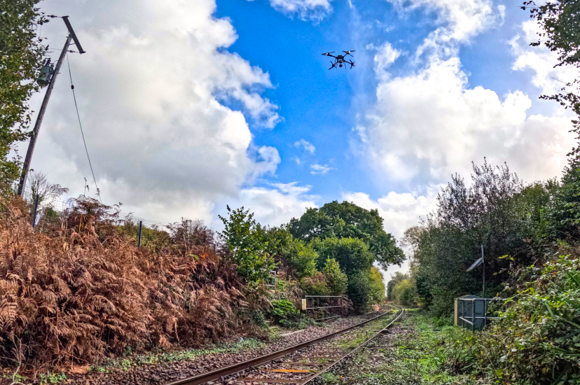
Skyports’ will deploy its Stellaire (previously Field) Explorer drone. The aircraft, which Skyports onboarded to its fleet in December 2023, is specially designed for linear infrastructure inspection and capable of simultaneously capturing a range of datasets, including nadir and oblique images, thermal images and LiDAR. The system is fully automated, capable of being flown beyond visual line of sight (BVLOS), and carries multiple sensors capable of simultaneously capturing a range of data.
Data collected by the Skyports and Ground Control service is instantly and securely uploaded to Stellaire’s analytics suite where AI is used to provide near real-time insights, depending on customer requirements. Insights can be as detailed as single-tree analysis, which can identify species, tree height, crown radius and health. This data enables risk-based analysis and informed decisions on vegetation management, while mitigating against damage to natural habitats, and reducing time and cost.
For more information