


Ted Driver, OneSky Head of Analytics and Operations
Reproduced with the kind permission of OnsSky. The original article can be found here: https://www.onesky.xyz/post/operational-risk-assessments-and-bvlos-flight-using-analytics-for-advanced-drone-operations
As we get closer to realizing flight Beyond-Visual-Line-of-Sight (BVLOS) and other advanced operations, the drone industry and aviation authorities are working to develop risk-based standards for how those operations will be approved. Today, ASTM F3196-18 outlines a standard procedure for applying for permission to fly BVLOS: and a major part of that process is the development of an Operational Risk Assessment, or ORA. ORAs for sUAS are also defined by an ASTM standard, F3178-16: they’re a complex and lengthy assessment of risk for a wide variety of criteria.
ORAs and CONOPS are critical tools for aviation authorities, who are ultimately responsible for granting final approvals for BVLOS flight. As my fellow researchers and I wrote in our recently published paper, Quantitative Analytics for Beyond Visual Line of Sight Operational Risk Assessments: Safe operations depend not only on airworthiness of an aircraft and robustness of its infrastructure, but also the environment in which the technology is deployed. The CONOPS describes the mission and environment and identifies potential hazards: the ORA analyzes each potential hazard and quantifies risk. The ORA is designed to help aviation authorities determine if the overall risk of the mission is acceptable.
Establishing quantitative risk and developing ORAs for BVLOS missions can be a time consuming and difficult process. At OneSky, we’ve been working on the problem of automating ORAs, using our deep analytical capabilities. We believe that automating Operational Risk Assessments is a critical step to making BVLOS flight safe, reliable, and broadly accessible.
Operational risk
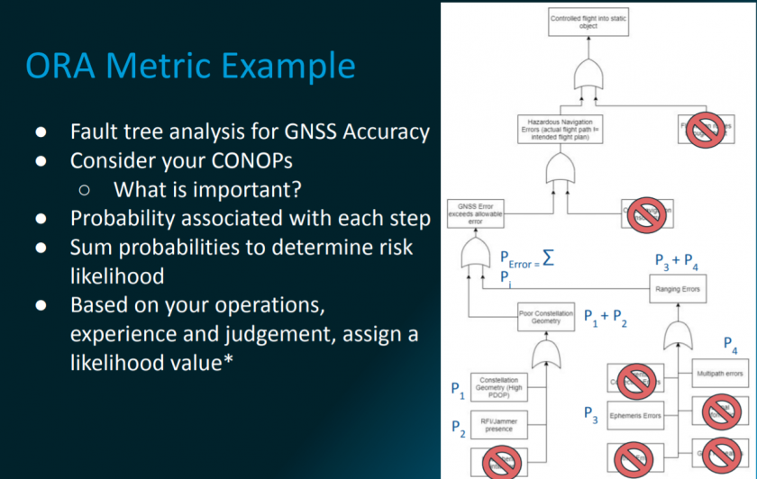
Operational Risk is a combination of risk severity and risk likelihood. Severity depends upon the specific mission, as defined in the CONOPS: are you flying over infrastructure, or people? If something were to go wrong, how bad would it be? Likelihood asks if something will happen: if there are communications outages, how long are they likely to last? Will navigation errors be under my threshold today?
It’s possible that portions of risk severity assessments can be automated, but we’ve focused our efforts on automating the modeling of risk likelihood. We can look at a variety of metrics, like navigation accuracy, communications performance, bad weather, lighting, or obstacles; and rate their likelihood of occurring, from extremely improbably to frequent. We do this by using analytical functions and then “tuning” the algorithm to specific conditions set by the operator and the aviation authority.
Aggregate risk
Today, OneSky uses analytics to help customers determine risk on all kinds of different factors, but sometimes – like for ORAs – we may just want a go/no-go decision, based on the aggregate risk. We can create an aggregate likelihood value which represents the overall risk for the entire route, including all the metrics under consideration for the flight. We can also look at one point in time of the planned operation, and determine the risk at that particular moment, such as the time at which your operations take you over a more populated area.
Using the data
For risk assessments to provide value to all the stakeholders, they must be presented in a usable way. The core of the OneSky system is high fidelity data, presented visually to provide a deep understanding of the airspace. The OneSky platform allows us to visualize risk likelihood in 3D space, over time. We’re looking at the best ways to present answers to fundamental questions for safe operations: what’s the likelihood of risk? Which identified hazard is raising your risk? When and where does the likelihood rise? When we combine these answers into clearly understood information, then we allow effective intervention when required.
Most importantly, clear visualization in 3D space allows risk information to be used and shared in a way that makes automation of Operational Risk Assessments possible and speeds the path to BVLOS flight.
What’s next?
Automating Operational Risk Assessments is a project that requires collaboration. We need to work with all stakeholders to establish standardized algorithms and data for consistent risk assessments. We need to continue working with operators to develop “tuned” algorithms that mirror reality as closely as possible: and with civil aviation authorities to determine what data they need and how that content should be delivered. We’re building the tools to make BVLOS flight and other advanced operations safe, reliable, and available as aviation moves into its next generation of growth and innovation.