

Kongsberg Geospatial, developer of IRIS Terminal airspace deconfliction platform, and The Longbow Group (Longbow), which operates the Unmanned Systems Research and Technology Center (USRTC) have announced that they are implementing the IRIS Terminal to provide multi-domain situational awareness, says the company press release.
Longbow evaluates and implements Unmanned Traffic Management (UTM) and Drone Detection Technology to develop the initial concept for a locally integrated UTM solution for Hampton Roads covering the management of both air and surface unmanned traffic. The key to safe operations is real-time situational awareness of both air and surface domains. Beyond Visual Line of Sight flights to/from Fort Monroe and NASA LaRC are envisioned. In 2021, Longbow signed a Space Act Agreement with NASA Langley for the development of BVLOS corridors and has partnered with Hampton University and the City of Hampton on the installation of a Skyler ground-based surveillance and weather radar in downtown Hampton. The BVLOS flights with NASA and supported by Hampton University student pilots will serve to establish the required system performance to enable initial maritime surveillance operations. BVLOS flights are anticipated in 2023 with several levels of build-up flight testing underway.
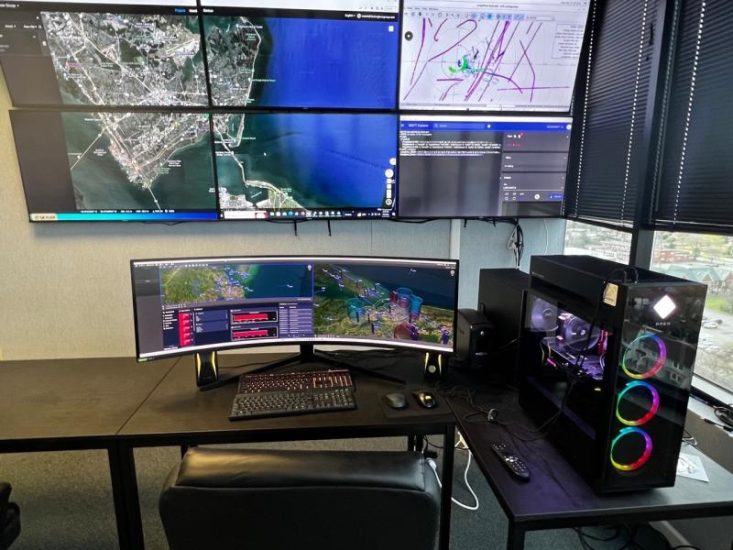
IRIS Terminal, now in its second generation, has been developed for the enterprise UAS sector for visualization of airspace traffic, as well as autonomous control of uncrewed systems in its GCS format. Ownship, cooperative and non-cooperative traffic are all visualized by IRIS Terminal in multiple viewing configurations, along with useful features such as DAA sensor footprints, terrain awareness, or potential conflict warnings. Where the same aircraft produces multiple tracks (one track per sensor), IRIS Terminals’ ‘smart correlator’ feature will correlate these multiple tracks into one single track to ensure the UI remains uncluttered and the operator can focus on the work at hand.
(Image: Longbow’s USRTC in Virginia uses Kongsberg Geospatial’s IRIS Terminal for PEGASUS UTM programme)
For more information visit:
