

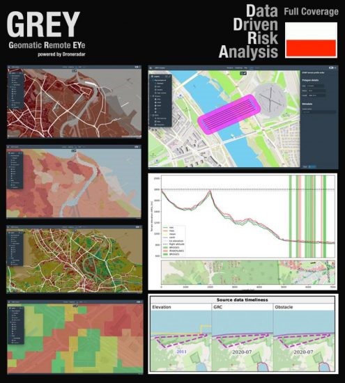
GREy by Droneradar.eu is a project launched in Poland to significantly shorten the implementation time of full Unmanned Aerial Systems (UAS) flight automation. The service provides electronic tools for beyond visual line of sight (BVLOS) permit submission and processing support based on comprehensive geo-data repository.
GREy supports validation of the declarative risk analyses generated in accordance to SORA, PDRA, STS or N-STS. In a few minutes, GREy can generate a report on the planned mission (Operational Flight Plan), including flight trajectory, contingency buffer, known obstacles, population density as well as heat risk maps.
The foundation of the GREy service are official state data (e.g. LIDAR or satellite) with data obtained from authorised orthophotgrametric flights supported by database containing information about slender obstacles, power lines, categorised according to the potential risk they may generate for particular flight.
GREy also supports Common Altitude Reference System (CARS) in area of access and distribution of highly scalable, high resolution Digital Surface Model (DSM) models.
At present, GRAY territorially supports Poland, and is designed to be applied to other locations in the future.
For more information visit:
www.droneradar.eu
