

Unified Traffic Management (UTM) technology provider Altitude Angel has released two updates to its map data providing drone operators and recreational users with details of airspace restrictions and NOTAMs (Notice to Aviators).
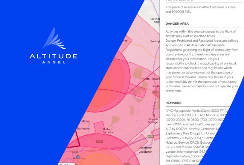
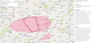
Following an update to Altitude Angel’s airspace data processing, it now publishes the Remarks for all ‘Danger, Prohibited and Restricted Areas.’ These are supplied by the relevant authority and typically provide other airspace users with more detailed information about the timing, nature of hazard, type of restriction, and authority contact details. For example, Salisbury Plain is now displayed as:
The second update has been to process some additional NOTAM categories. Altitude Angel continuously reviews the type of NOTAMs it publishes through its platform, assessing their relevance to UAS operations and disregarding irrelevant ones, such as ATM infrastructure (e.g. radar systems), aerodrome services (e.g. firefighting) and the like. The latest update to the map data means some additional NOTAMs will now be available to see on the Drone Assist app and dronesafetymap.com as well as CLOUD customers using Altitude Angel’s airspace data service.
The new categories are:
- GNSS area wide operations (relating to jamming trials)
- Obstacles (relating to cranes or rigs)
- Captive balloon and Kite.
For more information visit:
www.altitudeangel.com
