



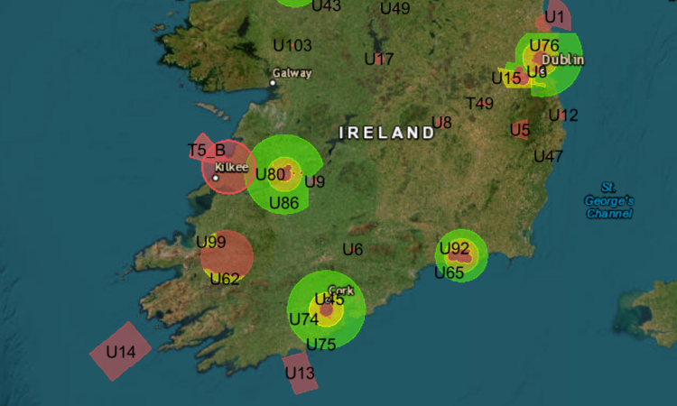
A survey of 30 European countries by drone flight operations company Dronetrake, has found just 11 countries provide UAS geographical zone information in the agreed format, four publish it without granting its use and 14 publish no file at all.
A UAS geographical zone is a portion of airspace stablished by the competent authority to enable, restrict or exclude UAS operations and Article 15 of Implementing Regulation (EU) 2019/947 asks for Member States to define UAS geographical zones and make the information public “in a common unique digital format”. The EUROCAE ED-269 standard was subsequently adopted as the standard format. Although most air navigation service providers and regulators publish “drone maps” which highlight exclusion zones relatively few are in the correct format, says Dronetrake.
The information and format is essential for drone operators working across national borders. “The practical outcome is that the serious operator ends up trusting commercial apps that aggregate data of uncertain provenance, or looking at nothing at all. Neither is what Article 15 had in mind,” said the company in a press release. “Meanwhile the common map published at European level covers two States and declares itself unusable for operational planning.”
“Across some thirty European countries examined, the picture splits into three groups of surprising size,” said Dronetrake . “Eleven countries publish a downloadable file under terms that allow it to be integrated: Bulgaria, Czechia, Cyprus, Estonia, Finland, Ireland, Luxembourg, the Netherlands, Portugal, Sweden and Switzerland — which is not in the Union. Four countries publish the file and then do not grant its use: Austria, Denmark, Germany, Spain. The technical work is there, and on top of it sits a clause — “personal use only”, “non-commercial use only”, all rights reserved and none granted — that keeps it out of any tool meant for pilots. Fourteen countries publish no file at all: Albania, Belgium, Bosnia, Croatia, Georgia, Hungary, Iceland, Italy, Lithuania, Moldova, Montenegro, Norway, Poland, Serbia. Norway has announced one, and the links do not work.”
According to Dronetrake:” Europe’s best case is Finland. Traficom publishes a complete ED-269 file — 731 zones — that downloads in a single HTTP request, with no registration. The page hosting it exists only in Finnish (the English version returns a 404), but the data is the right data, in the right format, within anyone’s reach. Czechia does something nobody else does: it publishes zone boundaries as GeoJSON files declared legally binding, alongside a generalised ED-318 version for geo-awareness. The distinction is explicit: the interactive map is for looking at, the reference files are what counts. The terms of use that come with the files add no prohibitions: AIRAC cycle, no warranty, Czech law. They can be used. Switzerland, outside the Union, serves an ED-269 file refreshed daily that also contains the three zones of Liechtenstein, which has no portal of its own.”
Poland, one of the continent’s most dynamic drone markets with an agency that pioneered beyond visual line of sight (BVLOS) and traffic management in Europe publishes no file, says Dronetrake. It has a map to consult and a system for filing flight plans. No documented interface is there; the service feeding the map answers, and a third-party QGIS extension uses it to extract KML files, but that is not published data — it is data taken.
“Italy did the work three times over, and none of the three is a file,” continues the survey text. “The Italian zones exist, they are maintained, and they are updated every AIRAC cycle: they sit in the AIP published by ENAV on behalf of ENAC, in sections ENR 5.1, 5.5 and 5.6. But the AIP is consulted as a document — pages, tables, coordinates in running text — behind a free registration: there is no zone file to download. The portal pilots know, D-flight, requires an account and warns, in a panel next to the map, that the information may be used “solely for one’s own use” and may not be passed on to third parties. Finally there is a route built for machines — a WFS service in AIXM, operational since June 2026 — but access is restricted: mutual certificates, accreditation, terms to be agreed. Three well-built roads, and not one a drone manufacturer can travel to read the Italian zones automatically.”
The Dronetrake survey ( https://dronetrake.com/press/zone-uas-europa?lang=en) is continuously updated with the latest verification date of 7 September 2026. Dronetrake is a European platform for professional drone operators.
Story update on 21 September 2026.
Since publication, Norway now does have a licence, and it is the most permissive in Europe: NLOD 2.0, the Norwegian licence for public data, added on 7 September. It allows commercial use, modification and redistribution, and it names third party applications explicitly, drone apps included.
Second, Germany does not forbid the use of its data. DIPUL publishes under CC BY-ND 4.0, attribution “dipul, CC-BY-ND 4.0”, and it says so in four different places on the site. What it forbids is derivative works. The earlier text also mentioned a contractual penalty o 1,000 euros: it is not on the DIPUL pages today.
Third, Cyprus, Estonia, Finland and Portugal publish no terms of use at all. They neither grant nor forbid: they say nothing, exactly like Ireland.
Fourth, the official Netherlands service on PDOK was withdrawn on 30 June 2026 at the request of LVNL; what is left is a file on another domain, frozen at December 2025, with no licence, while the terms of GoDrone expressly forbid downloading or redistributing.
The new count is this: seven countries publish a file and a licence that lets someone else use it, three publish it and restrict it, six publish it and say nothing.
(Image: Irish Aviation Authority)