

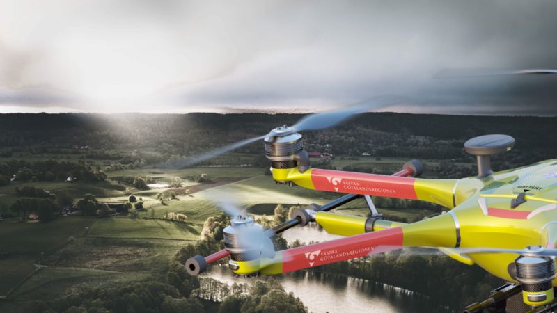
Sweden’s Västra Götaland regiona (VGR) is pushing to expand coordinated drone services. The region was the first to fly defibrillators to residents in distress, and tests are underway to film accident scenes so that the ambulance and other rescue forces can get a quick picture of the situation before they arrive, says report by the region’s digital news channel.
VGR is responsible for healthcare, culture, public transport and regional development in Västra Götaland. Recently, VGR’s strategic health and medical care committee decided to continue the drone investment for another three years and through a special gathering of forces, additional areas of use for drones are to be tested.
Magnus Kristiansson, VGR Innovation Manager said: “It’s about making sure that drones don’t collide with each other or with an ambulance helicopter or a building. We must ensure that you can fly safely and that everyone who is in the same airspace can communicate with each other. VGR is trying to take the lead to create an airspace in Västra Götaland. This would have very large positive effects on Västra Götaland but also Sweden as a nation.”
There is a government assignment to the Swedish Transport Agency to review how airspace/u-space can be created and managed. It is said that the first prototypes of the airspace’s various services can be in place by the year 2025 – 2026 and VGR’s part it is about trying to push so that it becomes a reality.
“VGR is on the needs side, we have lots of situations where we see a clear need to be able to fly with drones. To get this in place, we are trying to take responsibility, participate in the discussions with various parties and some on how we can create benefit with an airspace,” says Magnus Kristiansson.
Mikael Svensson, Process Manager, Supply Administration, VGR, said: “If we can reduce the number of miles we drive by car and replace it with drones, we get both economic and environmental benefits. VGR’s geographical area with both urban and sparsely populated areas, coastal and inland reflects Sweden very well and is therefore a good test ground for how to work with drones.
“Maybe medicine can be delivered directly to patients in sparsely populated areas in the future, food from home care can be delivered via air and even people could be transported using drones in the future.
“For VGR, it is, among other things, about offering equal and close care regardless of whether the residents live in a city or sparsely populated area, being able to save lives and at the same time use resources more efficiently. But it is also about being an attractive region and connecting research and companies.
“We have seen a rather large need to coordinate at a higher level and there we are now trying to join forces together with the relevant authorities,” says Magnus Kristiansson.
Traffic rules for the air
A crucial part of being able to utilize the potential of drones is to create a functioning airspace. Unlike manned air traffic, which moves higher up and is monitored by air traffic control towers, drone traffic moves at significantly lower altitudes. But there it must coexist with other traffic at low altitude and right now there are no clear rules of the game.
“You can compare it to us that we need to establish roads with traffic rules fixed in the lower part of the air. Today, the traffic is a bit chaotic and you are forced to block off airspace for certain traffic and have very close contact and large margins to others flying,” says Anna-Lena Alvekran’s innovation leader at the Innovation Platform, VGR.
At EU level, this airspace is called U-space and is a central part of managing the increasing drone traffic. U-space is more than just an area of airspace; it is an integrated system of digital services and automated solutions aimed at creating a safe and efficient airspace for drones.
The basis for U-space is a set of regulations that consists of various services:
- Network Identification Service: This service ensures that drones can be identified in real time during flight, transmitting important information such as position, direction, altitude and speed.
- Geoawareness Service: Provides operational conditions, airspace restrictions and information on available GEO zones. That is, in which geographical areas the drone moves.
- Flight Permit Services: These services handle requests to fly in U-space airspace and inform of any approvals or denials.
- Traffic information service: Important to inform about other visible traffic nearby, both unmanned and manned.
(Image: VGR, Viggo Lundberg/Westsweden.com and Innovationsplatformen)
For more information visit:
