


Drone services company Skyward has introduced a new feature on its Aviation Management Platform that tracks active drone flights in real time. The latest capability enables drones to be monitored from anywhere with connectivity, and serves as a foundation for Skyward’s implementation of Remote ID. For pilots in the field, it increases situational awareness and supports coordination during complex aviation operations.
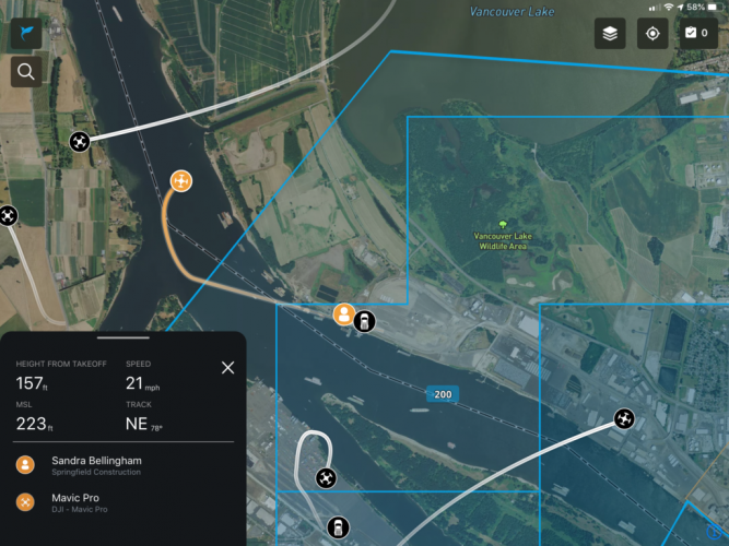
According to Skyward, when subscribers fly with the company’s InFlight mobile Ground Control Station (GCS), aircraft information is sent into Skyward’s new Live Flights map. The map provides information including the drone’s location and flight path over the last 60 seconds. When you click on a drone, the map displays detailed information about the flight including aircraft ID, location, altitude, and velocity, as well as the location of the GCS and key pilot information. This information is visible on Skyward’s web and mobile apps to everyone within the organisation.
Customers with an Enterprise Skyward subscription can also use InFlight to self-report their location, flagging the position of items such as vehicles, observers, drones not compatible with InFlight, or landmarks. And administrators of enterprise accounts can see live flight information for all the organizations they manage.
For more information visit:
https://skyward.io/new-in-skyward-live-flight-tracking-for-drone-operations/