


The United States National Weather Service (NWS) and GreenSight have signed a one-year Cooperative Research and Development Agreement to deploy an uncrewed aircraft system, called WeatherHive, to measure atmospheric conditions and evaluate if the data could aid in weather forecasting. The demonstration project will take place in and around Tulsa, OK. The NWS plans to expand testing to other sites later this year.
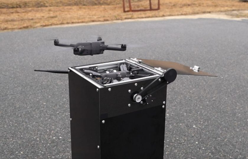
WeatherHive’s uncrewed nano drones, called WISPs, gather real-time atmospheric measurements – pressure, temperature, humidity, and wind speed and direction – that can be used to forecast the weather. Each “hive” contains 10 WISPs spanning a 300-square-kilometre area reaching altitudes up to five kilometres, generating a 3D cube of measurements. Capable of operating in rain and winds up to 39 mph, WeatherHive provides critical observations within the planetary boundary layer that can be used for weather forecasting. The NWS is looking at what height they can fly safely during more severe weather.
Dozens or hundreds of WeatherHive’s drones can be used at once to gather large quantities of data. Remotely deployable, the palm-sized drones automatically launch and land in their “hive” for recharging and reuse. The fully autonomous system provides approximately 50 minutes of sampling per flight that can be repeated continuously.
The terms of the new agreement will see GreenSight and the National Oceanic and Atmospheric Administration, which oversees the NWS, develop five demonstrations of the system in the US for data analysis, assessment, and safety. The combined team will then evaluate data collected and capture input to optimise data collection sampling patterns and swarming techniques.
For more information
Image: GreenSight