

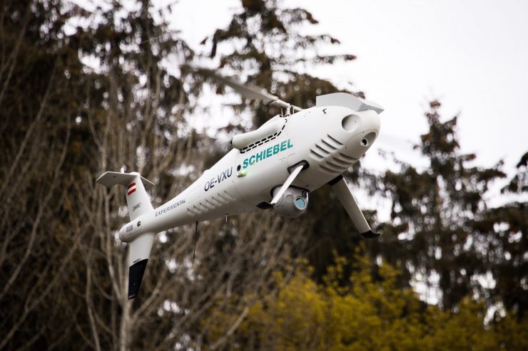
Drone operator Aerial Robotix is using Kongsberg Geospatial’s IRIS Unmanned Aerial System (UAS) situational awareness application to provide safety critical airspace deconfliction supervised by the Nigerian Civil Aviation Authority (NCAA) to enable conduct of long range BVLOS operations. According to a report published by sUAS News, Kongsberg Geospatial enables Aerial Robotix to conduct BVLOS Pipeline Inspection demonstration flights in the Niger Delta using Schiebel’s CAMCOPTER S-100 UAS.
Aerial Robotix provides operations for oil and gas inspection using professional certified UAV operators. The company uses a variety of platforms ranging from small fixed-wing and quad-copter drones to large gas-powered rotary wing aircraft. Schiebel’s CAMCOPTER S-100 UAS is a Vertical Takeoff and Landing (VTOL) craft that operates around the clock with a beyond line-of-sight capability out to 200 km, over land and sea.
“Safe BVLOS unmanned flight operations require the very best in equipment and technology,” said Kolapo Sodeinde, CEO of Aerial Robotix. “We would not have received regulator approval from the NCAA or the client company to conduct BVLOS inspection flights without the Kongsberg Geospatial airspace deconfliction application.”
The Kongsberg Geospatial IRIS display technology enables multiple drones to be monitored simultaneously by a single operator and provides real-time calculation of aircraft separation, airspace monitoring and communications line-of-sight to enable BVLOS operations. IRIS integrates a variety of data feeds including ADS-B and radar to provide “detect and avoid” warnings. IRIS provides real-time 2D and 3D visualization of airborne track and weather data, as well as geo-fencing capabilities.
(Image: Schiebel)
For more information visit:
