


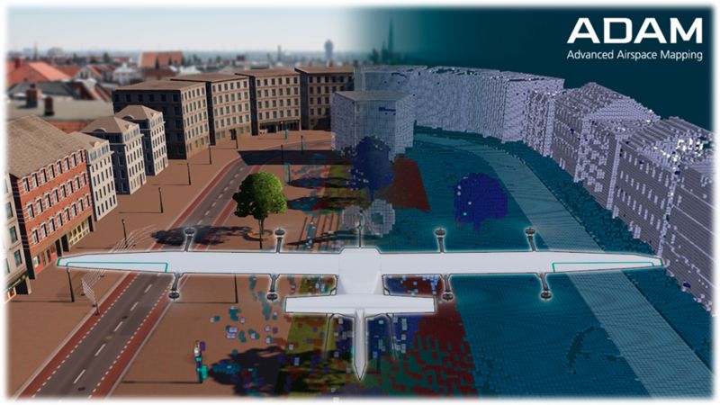
Fraunhofer-Gesellschaft and Continental Automotive Technologies have launched the Advanced Air Space Mapping (ADAM) project to increase the operational safety of UAS through the use of 3D maps. The partners aim to simplify certifiability of autonomous flight and support the federal initiative to establish a German UAM lead market. By using annotated 3D maps, drones reduce on-board sensors and prioritise detection of other airspace users as well as increase redundancy.
Droniq is providing the voxel maps to the drone operators via its UTM Traffic Management System, which will be further developed as part of the research project. The voxel maps provide safe, redundant trajectory planning at flight altitudes below 150 m. The generated maps are integrated into the UTM as an extended/optional geo-awareness service for use within the U-Space .
Project funding: Federal Ministry for Digital and Transport (BMDV)
Project partners: Fraunhofer IVI | Fraunhofer IOSB | Continental Automotive Technologies | Sedenius Engineering GmbH | Technical University of Munich | BIT Technology Solutions | Airclip Services | Paul & Kayser Engineer Society | AEF.
For more information visit: