


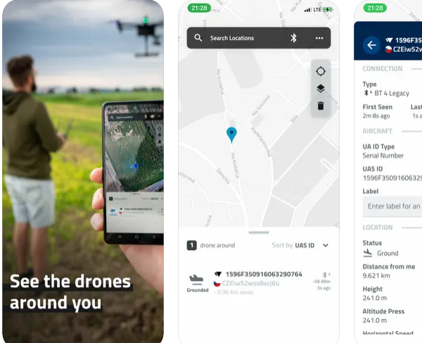
A mobile App developed by Czech company Dronetag enables users to visualise the current airspace including other participants using Remote Identification (Remote ID) data. The company’s Drone Scanner is designed to turn a phone or tablet into a a drone scanner and track all the nearby flights over direct/broadcast Remote ID standards. Users can browse real-time data about drones on a detailed map highlighting specific flying space zones. The Drone Scanner is available to download for free. User features include:
– Discover more about drones flying nearby in real-time
– Examine detailed information broadcasted by drones via Bluetooth 4, Bluetooth 5, Wi-Fi Beacon, and Wi-Fi NAN
– Browse a detailed map with your location and all nearby aircraft
– Check available data about drones, including real-time height, direction, pilot identification, pilot position, operation description, and location history
– Various flying zones marked and highlighted on the map
– Easy export of collected data
– Continuously updated to reflect the latest EU & US regulations
Direct Remote ID is a feature that transmits live flight data via Bluetooth or Wi-Fi to the surrounding area. Drone manufacturers use various technologies to build an identification feature in new drones. Pilots of older drones are using add-on devices, enabling them to become digitally visible. With hardware on your smartphone, Drone Scanner can receive and read broadcasted data.
For more information visit: