


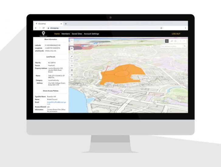
UK drone services provider DronePrep has released V1.0 of its DronePrep platform, designed to support safe integration of drones into UK airspace. V1.0 includes over 56 million land parcels, mapped out against multiple other data sets, flight restriction zones, crown estate foreshore, National Trust Land, sites of special scientific interest (SSSI), etc. DronePrep also provides details of why and how drone operators can register their drones in accordance with the UK’s Drone and Model Aircraft Registration and Education Service (DMARES).
The platform enables drone pilots to search for any Landowner, seek permission and find places to fly your drone responsibly. It enables landowners to communicate drone access policies to the drone community and access a network of responsible flyers.
For more information visit: