

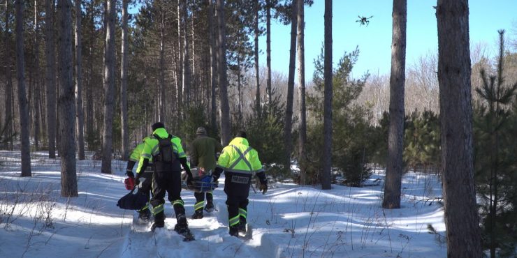
Public Safety Canada has selected Kongsberg Geospatial, Larus Technologies and the Civil Air Search and Rescue Association of Canada (CASARA) to integrate geospatial software, artificial intelligence, and machine vision software to help develop new methods for the use of drones in search and rescue operations in remote communities in Canada.
The project will be funded by the Search and Rescue New Initiatives Fund (SARNIF) and has been dubbed OVERSEE – an acronym for “Optical Vision Enhancement and Refinement of Sensor Exploitation Effectiveness”. The OVERSEE project is intended to help address the unique challenges of conducting search and rescue operations in remote areas (such as indigenous communities in the Arctic and their immediate surrounding area) with UAS platforms.
OVERSEE will initially employ available search and rescue statistics from the Department of National Defence, CASARA, Transport Canada and other agencies and execute simulations driven by Artificial Intelligence. The AI will use Deep Learning techniques to investigate how BVLOS regulation effects SAR efforts that make use of drones, and how drones have been integrated most effectively in search and rescue operations, particularly for isolated indigenous communities in Canada’s North that don’t have quick access to Aeronautical search and rescue assets.
Ultimately the goal of this research is to help CASARA members and GSAR (Ground Search and Rescue) workers use BVLOS drones more effectively in search and rescue operations.
Kongsberg Geospatial will be leading the project, contributing their expertise in precision mapping, Air Traffic Management, and the development of multi-vehicle UAS control stations for BVLOS missions to help develop tools and procedures for the safe, effective use of drones for search and rescue missions in remote areas. They will also be contributing tools and training for machine vision techniques.
Larus Technologies specializes in Intelligence Surveillance and Reconnaissance (ISR) systems for defence applications, and will be contributing their Total::Perception™ simulation engine and Total::Vision™ computer vision technology to the project.
CASARA will be helping to gather drone video from training exercises throughout Canada in cooperation with its volunteers, as well as search and rescue event statistics from community organizations. Upon completion of the project, CASARA membership will help to circulate the SOPs derived from the project to their membership of Civil Air Search and Rescue workers and volunteers across Canada to ensure that everyone has access to the improved UAS SAR guidance.
While the project is primarily funded through Public Safety Canada’s SARNIF fund, all three partners will be making in-kind contributions in software licenses, technology, and professional services.
The OVERSEE project is expected to be completed sometime in 2021.
(Image: Kongsberg Geospatial)
For more information visit:
