

Australia’s Civil Aviation Safety Authority (CASA) has approved AirMap among its list of authorised providers of geo-awareness services to operators of unmanned aerial systems (UAS) in Australia. As part of CASA’s RPAS platform, AirMap will deliver up-to-date, contextual airspace information to UAS operators so they can visualize airspace advisories and restrictions, plan safe flights that are compliant with CASA regulations, and maintain situational awareness throughout their missions.
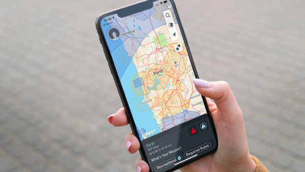
AirMap works with Civil Aviation Authorities to digitize, contextualize, and distribute official aeronautical information to UAS operators via publicly available digital formats. With the AirMap for Drones application for web and mobile, UAS operators in Australia can access authoritative data, including controlled traffic regions (CTRs), updates from Australia’s Fire and Emergency Services, information regarding flights over Australia’s marine parks, and CASA advisories, notifications, and regulatory information.
“The RPAS platform gives drone operators access to an ecosystem of application providers and lets them choose which provider they want to connect to,” said Luke Gumley, Branch Manager RPAS at CASA. “AirMap meets our standards for drone safety applications, and we are pleased that the AirMap application is now available to drone operators in Australia.”
For a list of CASA-approved flight booking suppliers visit: www.casa.gov.au/drones/safety-apps
For more information visit:
