

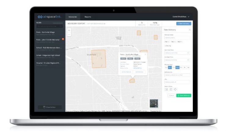
Airspace Link has launched AirHub™, a cloud-based drone platform focused exclusively on merging the needs of state and local government with the operational planning tools already in use.
“One of the primary challenges communities face are pilots unfamiliar or unaware of the changing and often dynamic local and federal landscape for drone regulation,” says the company’s website. “Airspace Link provides web applications and API-driven plugins to enable rule-based guidance and decision making for drone related activities. In short, the AirHub™ platform provides both pilot and government airspace planning tools….Our mission is to help communities safely manage drone integration while building new economic development opportunities for businesses and citizens.”
According to the company the new service:
- Enables the drone industry to use the safest drone operational locations or routes in the community.
- Provides single authoritative data source across multiple levels of government.
- Protects citizens’ safety while supporting drone operations with clear advisory risk areas.
Airspace Link is a FAA supplier of Low Altitude Authorization & Notification Capability (LAANC). The new tool is aimed local authority and community based organisations planning for drone flights over people in urban areas. “For the first time ever, communities clearly map FAA data with local government regulation on a single platform. Communities easily communicate with the drone industry regarding local and often dynamic advisory areas….Drone pilots receive federal AND local government sign-off for safer flight planning within seconds. Integrating community data ensures pilots quickly understand airspace advisories, rules and risk to each flight plan.
For more information
