


DroneShield has released its Q3 2026 software release, introducing capability enhancements to DroneSentry 2.
Customers on disconnected or highly secure networks can now update independently using removable media, reducing reliance on remote support. Additionally, with the new cloud-optimised GeoTIFF (COG) maps, users can load their own offline mapping into DroneSentry-C2, providing flexibility in remote locations, overseas deployments or environments where commercial mapping is unavailable or unsuitable.
The Q3 release has also expanded interoperability, including:
- SentryCompass support, delivering positioning through dual GNSS receivers with inertial navigation fallback.
- Robin Radar IRIS On-The-Move support, for mobile radar deployments.
- Evica PinPoint Searchlight support, for improved visual target identification in low-light conditions.
- Broader third-party sensor support via DroneSentry-C2’s generic sensor framework.
- Additional language support: Dutch, German, Ukrainian and Japanese.
The Q3 2026 software release is available now through the DroneShield Access Portal for eligible customers with active subscriptions.
For more information
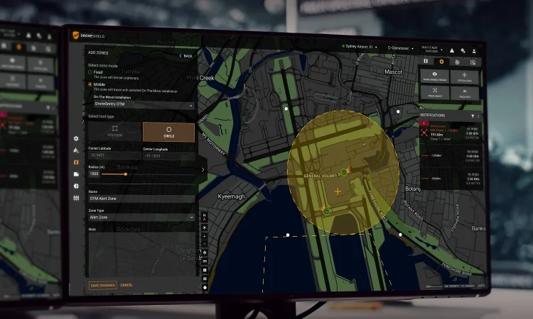
Image: Operators can configure Fixed or On-The-Move zones in DroneSentry-C (DroneShield)
The 2026 Unmanned Airspace Global Counter-UAS Systems Directory is now available. The guide is the world’s only comprehensive, continually updated directory of global C-UAS companies and systems. It itemises over 1,000 C-UAS products and services with performance details, company sales and partnerships arrangements. It is updated every month and broken down into niche sub-sectors (net-capture, missiles, intercept drones, detectors etc) to give C-UAS procurement and industry personnel a unique perspective of global C-UAS technical capabilities and market positions. It is available in word, PDF and excel formats and Unmanned Airspace readers are eligible for a range of discounts. For more information about the Directory please contact the editor Philip Butterworth-Hayes at philip@unmannedairspace.info.