


By Philip Butterworth-Hayes
Project BLUEPRINT stakeholders today gave an update on the project which aims to develop the UK’s first drone zone, using transponders to ensure drones and aircraft stay safely separated from one another.
The consortium expects a drone zone to be established around every major town and city in the UK by 2027, according to the project’s lead Neuron, with corridors linking drone zones to create a network that can enable medical deliveries, infrastructure monitoring and last mile deliveries such as those by Amazon Prime Air, Google Wing, and Manna
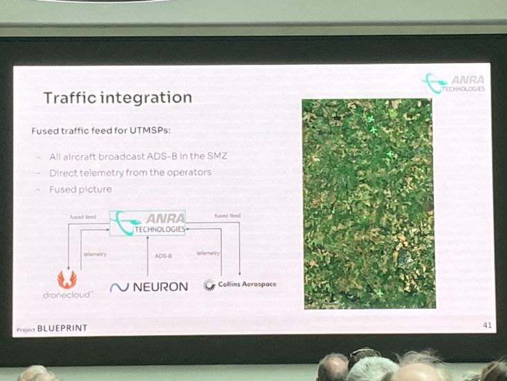
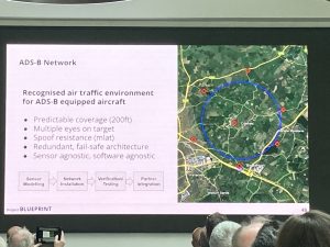
At the heart of the UTM system under evaluation is an integrated UTM/ATM network with Neuron developing the framework. This includes an ANRA UTM data processing system, two UTM service providers – Collins and DroneCloud – an air navigation service provider – Cranfield Airport – supported by a network of ADS-B sensors.
The common information system comprises a discovery and synchronisation service, e-identification, geo-awareness, traffic information and ATM permissions.
Cranfield University and Southamton University is also building a non-cooperative detect and avoid capability into the BLUEPRINT network, using an AI based algorthim which also includes wind-field estimates.
“The programme builds on recent work by the UK regulator, the CAA, who published a report earlier this year that recommended the use of transponder mandatory zones (TMZs) to enable BVLOS drone operations. Our consortium will be one of the first to implement this in a real operational environment, paving the way for others to learn from and help develop the standards, protocols, and procedures for implementation.,” said Neuron.
The two- year project, which concludes in 2024, will create an open-source blueprint for how to solve the BVLOS drone problem, and allow anyone to use it to create their own drone zone within their local area.