



By Patrick Maple
Beyond visual line of sight (BVLOS) drone operations have shifted from waiver-dependent exception to a defined regulatory pathway faster than most of the industry expected eighteen months ago. In the United States, the Federal Aviation Administration (FAA)’s Part 108 rule, the most substantial overhaul of unmanned aircraft regulation since Part 107 itself, is set for final publication in March 2026, following a public comment period that closed in October 2025 and drew more than 3,000 responses from industry stakeholders. Where Part 107 constrained BVLOS to case-by-case waivers, Part 108 replaces that model with defined operational approvals covering entire routes or areas. For commercial operators running agricultural drone mapping and infrastructure inspection programs, the shift from individual waivers to routine approvals changes both mission planning and the economics behind large-scale aerial data collection.
Where the regulatory shift is landing first
Linear infrastructure inspection, including pipelines, power lines, and rail corridors, is emerging as the sector best positioned for scaled infrastructure inspection drone programs under the new framework. The reasoning is structural rather than technological: infrastructure corridors follow predictable, mapped paths, which simplifies the airspace coordination that regulators require before approving extended-range operations. American Tower Corporation has already been running BVLOS drone inspections across cell tower networks in remote areas, replacing physical climbs with aerial data collection, an example of the operational logic regulators are now trying to formalize at scale.
Agriculture is following a similar trajectory outside the US. In Australia, the Civil Aviation Safety Authority’s TMI 2025-03 framework has enabled dock-based BVLOS operations across mining and agricultural sites, with agriculture positioned as the next major beneficiary of the shift. The distinction matters operationally: mining BVLOS approvals typically cover a single, well-defined lease boundary, while agricultural operations often span multiple properties across a region, so the ability to secure one broad-area approval instead of parcel-by-parcel authorization is what actually unlocks scale for operators serving that sector.
Why multispectral missions specifically benefit from extended range
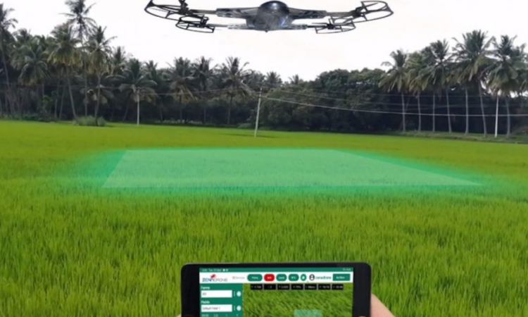
Multispectral drone survey work and NDVI-based crop monitoring have always been constrained less by sensor capability than by coverage rate under visual-line-of-sight limits. A pilot repositioning periodically to keep a drone within sight caps how much ground a single mission can realistically cover, regardless of how efficient the sensor payload is. BVLOS removes that constraint directly, opening the door to multispectral imaging agriculture that covers significantly larger contiguous acreage in a single pass than fragmented VLOS missions ever could
This has a specific implication for drone data consistency, one that matters more to analysts than to the flight itself. Multispectral time-series comparison, tracking vegetation stress or crop health across a growing season, depends on capturing large areas under comparable conditions in a single pass. Splitting a large field into multiple VLOS missions across different times of day introduces lighting and reflectance inconsistencies that complicate that comparison. A single BVLOS pass covering the same ground reduces that variability at the data level, not just the operational level.
What operators are still working through
None of this removes the operational complexity BVLOS still carries. Detect-and-avoid systems remain a prerequisite rather than an optional add-on under every framework moving toward routine approval, whether FAA, EASA, or CASA. The UK Civil Aviation Authority’s own roadmap toward routine BVLOS by 2027 explicitly builds in an intermediate phase of Temporary Reserved Area sandboxes specifically to test detect-and-avoid integration before wider rollout, an acknowledgment that airspace integration, not sensor payload, remains the harder engineering problem.
Reliable connectivity across extended range is the other constraint operators are actively solving for rather than one already resolved. Cellular-based command and control links are increasingly displacing traditional radio-frequency control for exactly this reason: BVLOS missions covering large agricultural or infrastructure corridors need a control link that doesn’t degrade with distance the way line-of-sight RF does.
The economics behind the shift
The market-level numbers underpinning this regulatory push are substantial by most industry estimates. BVLOS-enabled drone services are projected to grow from roughly USD15.36 billion in 2025 to USD25.32 billion by 2030, driven largely by exactly the sectors discussed here: agriculture, infrastructure inspection, and logistics. That growth curve assumes regulatory clearance keeps pace with demand, which is precisely what Part 108, the UK’s phased BVLOS roadmap, and Australia’s TMI 2025-03 framework are each attempting to deliver on different timelines.
What ties these regulatory tracks together operationally is a shared premise: BVLOS doesn’t just extend range; it changes the unit economics of aerial data collection. A mission that previously required multiple VLOS flights, multiple site visits, and multiple data reconciliation steps collapses into a single pass. For multispectral and NDVI-based monitoring specifically, where data consistency across a large area directly affects analytical accuracy, that consolidation is the more consequential change, not simply that drones can now fly farther, but that the data they collect while doing so becomes more internally consistent.
Patrick Maple is Chief Editor at DroneAsAService.com, covering BVLOS drone operations, multispectral mapping, and aerial data applications for infrastructure, agriculture, and industrial inspection.