UK Flight Ltd has today launched Flight Survey, an affordable flight planning and mission management tool giving drone operators details on airspace NOTAMs, airport zones, weather forecasts, nearby missions, local hazards and vulnerabilities, integrating all flight planning activities into a single process.
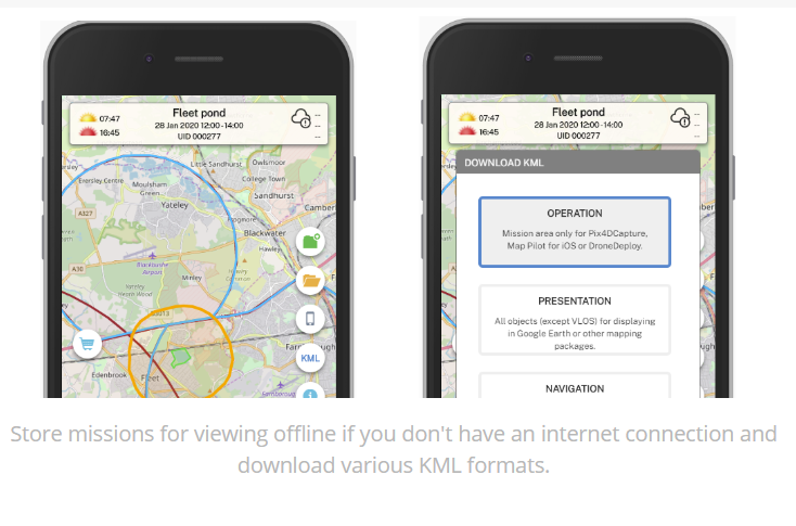
“The app can be installed straight from the website to Android and Apple mobile phones,” says Paddy Evans, Managing Director, Flight Ltd. “Missions can be created along with the hazards and warnings which can be stored for offline viewing. The mission can then be opened up on the desktop for enhancement and any changes are stored on the app when it re-opens it.”
“It also includes new functionality which allows the user to download KML for the mission and then import into either drone control software, Google earth or satnav software to help locate positions specified in the desktop planning process. It means that commercial and recreational drone users can keep a record of the flight planning and mission management operations for insurance and post-operations analysis purposes.”
The initial version has been launched today for UK drone operators; European Union and North American versions will be released within the next few weeks with an upgrade path for existing UK users who want the full EU version.
For more information