


HTX’s Robotics, Automation and Unmanned Systems (RAUS) Centre of Expertise (CoE) in Singapore has been developing counter-unmanned aerial systems (C-UAS) that can cope with severe radio spectrum congestion. The company presented these at the Milipol Asia-Pacific TechX Summit last week
One such system is the Rapid Deployable C-UAS System (RDS), which integrates multiple detection sensors with smart countermeasures. RDS is a lightweight, autonomous platform which has been designed for portability. The modular and scalable system can be set up for temporary or permanent installations and is also configurable as a single system deployment or networked with other systems that are deployed on site. RDS incorporates advanced radar with urban de-cluttering functionalities, a drone detection, identification, and tracking system; and drone jamming capabilities.
RAUS CoE is also developing a drone hunter that is designed to operate without the need for Global Positioning System (GPS) navigation. Instead, it navigates by using ground radar which provides guidance commands to the hunter to detect, pursue and capture rogue drones. The GPS-independent drone hunter is capable of rapidly pursuing and capturing rogue drones in GPS-denied environments. It can then jettison these captured drones at designated “safe” zones for safe payload removal and disposal.
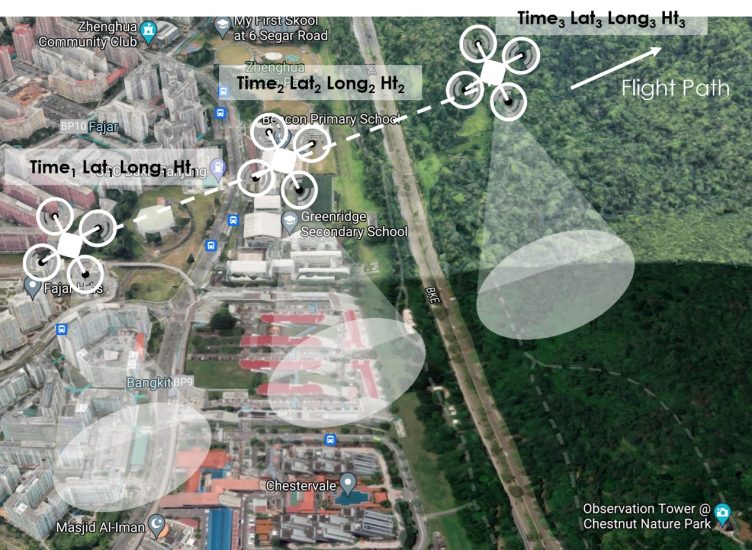
In addition, RAUS CoE has also been developing drone capabilities, such as NavSight – a GPS-independent navigation system which allows drones to operate in GPS-degraded or GPS-denied environments. Drones equipped with the NavSight system have their routes pre-programmed into them before their flights. During their operations, they use their downward-looking cameras to visualise their surroundings in real-time and calculate their positions by comparing their surroundings with their pre-loaded routes. Drones equipped with NavSight are also capable of tracking ground and aerial objects and identifying and avoiding obstacles.
For more information
Image: HTX screenshot showing GPS-independent drone flight path from Bukit Panjang to Chestnut Nature Park