


UNIFY.C2, an airspace command-and-control and sensor-fusion platform built by SPS Aerial Remote Sensing is to integrate Dronetag’s Remote ID capabilities into its operating environment.
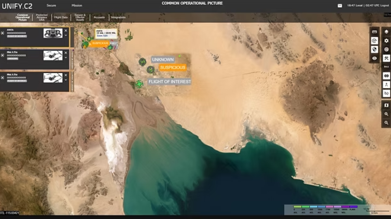
Dronetag is now available within UNIFY.C2 as an integrated partner, enabling operators to ingest and correlate cooperative drone identification data alongside radar, RF, EO/IR, acoustic and other sensor sources. This integrated system enables teams to distinguish compliant, authorised UAS activity from non-cooperative or unknown tracks.
Operators can now visualise Remote ID-equipped drones in real time, correlate them against other sensor detections and apply operational rules, alerts and logging within the same command-and-control interface.
For more information
The 2026 Unmanned Airspace Global Counter-UAS Systems Directory is now available. The Guide is the world’s only comprehensive, continually updated directory of global C-UAS companies and systems. It itemises over 1,000 C-UAS products and services with performance details, company sales and partnerships arrangements. It is updated every month and broken down into niche sub-sectors (net-capture, missiles, intercept drones, detectors etc) to give C-UAS procurement and industry personnel a unique perspective of global C-UAS technical capabilities and market positions. It is available in word, PDF and excel formats and Unmanned Airspace readers are eligible for a range of discounts. For more information about the Directory please contact the editor Philip Butterworth-Hayes at philip@unmannedairspace.info.