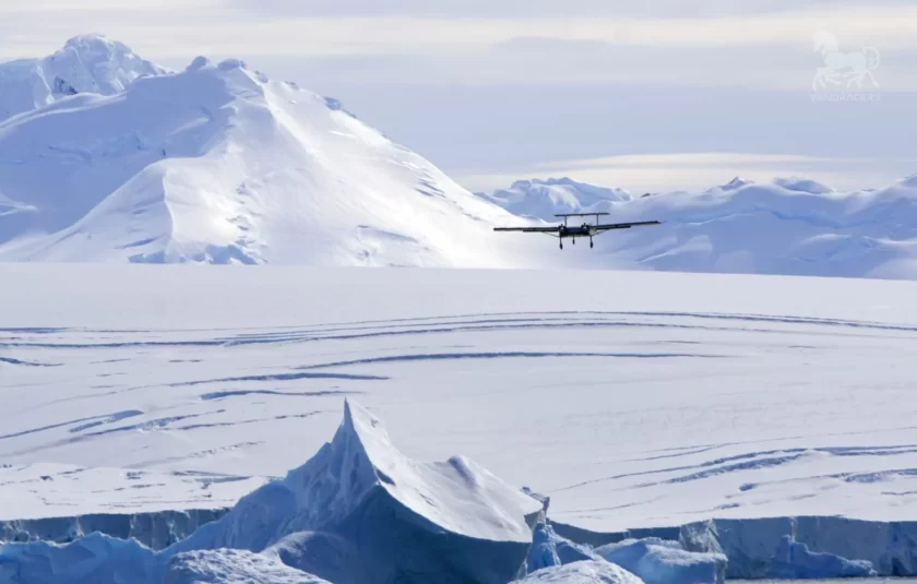
Windracers, the UK-based designer, manufacturer and operator of Windracers ULTRA, an autonomous heavy-lift cargo aircraft, has helped British Antarctic Survey (BAS) unlock new data in previously uncharted parts of Antarctica.
In a world-first for drone-assisted science, BAS employed Windracers ULTRA for autonomous Beyond Visual Line of Sight (BVLOS) missions to map out remote parts of West Antarctica and investigate how the Earth’s crust was created and deformed, said the company in a press release.
“The new research, published in the Journal of Geophysical Research, used state-of-the-art gravity and magnetic sensors to reveal huge bodies of frozen magma, hidden below the icy sea. Photos of previously unexplored islands, taken at the same time, show how these rocks were deformed as the mountains of the Antarctic Peninsula were pushed up by movement of the Earth’s tectonic plates.
“Until now, the lack of data from this remote area meant scientists had limited understanding of the region. Using the long-range, heavy-lift capability and autonomous operation of Windracers ULTRA, BAS experts were able to quickly and effectively map out the hidden geology of this inaccessible region.”
The SWARM project demonstrated Windracers ULTRA’s value in real-world survey and logistic settings, proving its potential for future deployments in remote and challenging environments around the world. The SWARM project was funded by UKRI Innovate UK.
Later this year, Windracers will also launch a new operational hub in Malawi to support middle-mile delivery of humanitarian across Africa.
For more information
Windracers ULTRA drone unlocks new secrets of Antarctic geology