SkeyDrone has released updates to its Drone Radar and Drone Analytics systems, designed to improve monitoring and give users more flexibility in how they interact with the platform.
New advanced monitoring preferences for control zones and flight plans enable users to tailor their settings per zone or flight plan without affecting their default configuration.
This covers alerts for intrusions, conformance issues, or other specific events. Users can configure default preferences that will be automatically applied to any newly created zone or flight plan, eliminating the need for repetitive manual configuration.Control zones will still be created and managed at the organisational level to maintain consistency.
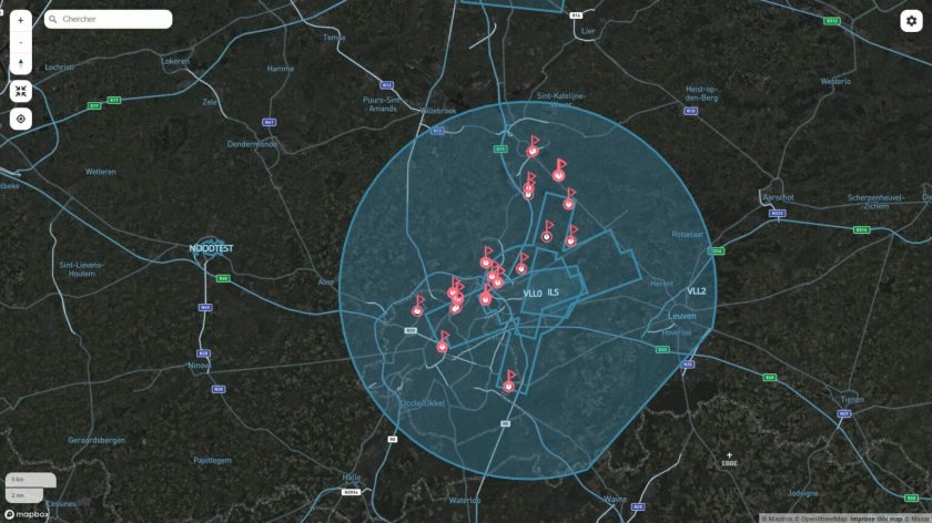
Following user feedback, Drone Analytics now offers a clear visual display of control zones and Areas of Responsibility directly on the map. These zones can be shown or hidden simply in the map settings. Drone Analytics users can also now adjust filters without losing their current zoom level.
The Twilight Street-Satellite Map is now the default map style in both Drone Radar and Drone Analytics. This hybrid view combines detailed street maps with high-resolution satellite imagery. SkeyDrone says that the darker tones increase contrast and improve drone visibility, especially in busy or complex airspaces.
Custom labels are now available with the recently introduced whitelisting feature. Users can tag whitelisted drones with names, use cases, or operator identifiers, which can make sorting and identifying friendly traffic simpler and faster during real-time operations.
In addition, users can now customise their platform with individual settings for measurement units (metres or feet), time display (UTC or CEST), and interface theme (dark or light mode). These preferences are saved at the user level and automatically applied in future sessions.
For more information