

The Federal Aviation Administration (FAA) has awarded drone operator Spright a nationwide, non-geospecific Certificate of Waiver (CoW) for Beyond Visual Line of Sight (BVLOS) drone
Read moreCategory: UAS traffic management news
Four airports in New Caledonia partner with Air Space Drone to provide unmanned airspace services
Drone services company Air Space Drone has added four airports in New Caledonia to regions supported by its FlyBy drone application. Drone operators can now
Read more
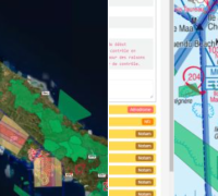
Solutions to support unmanned airspace management dominate line-up for ENAIRE business challenge prize
Solutions aimed at safe integration of new airspace users dominate list of finalists competing for the Business Ideas Competition launched by Spanish air navigation service
Read more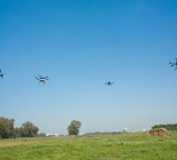
Airwayz to take part in second phase of Israeli-funded USD2 million drone initiative
Uncrewed Traffic Management (UTM) company Airwayz has secured funding to participate in the second phase of the Israel National Drone Initiative (INDI), after successfully completing
Read more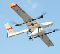
TechEagle establishes drone delivery hub and network in Meghalaya, India
Indian drone delivery company TechEagle has established a drone delivery hub and network in Meghalaya in partnership with the Government of Meghalaya, MHSSP and the
Read more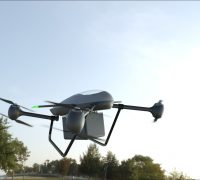
Heven Drones launches hydrogen-powered drone for commercial and defence markets
Heven Drones has launched its first hydrogen-powered drone for commercial use, the H2D55. With 5-times greater energy efficiency than traditional lithium battery-powered drones, the H2D55
Read more
European DEGREE initiative aims for safe UAS operations in the ‘specific’ category
Most UAVs can be directly employed for the Open Category of UAS operation that, considering the risks involved, does not require prior authorisation by the
Read more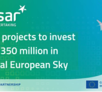
Europe invests EUR350 million in digital European sky projects, promotes U-space uptake
The SESAR 3 Joint Undertaking has announced 48 new projects as part of its Digital European Sky research and innovation programme. Representing a total investment
Read more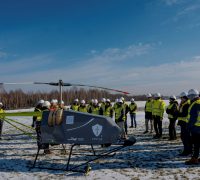
Ventus Heavy Lifting Service demonstrates unmanned helicopter first public flight
Ventus Group and partner Unmanned Helicopters launched a new Heavy Lifting Service during two demonstration days in Poland. An unmanned helicopter UH-200-Beyond-M took flight, picked
Read more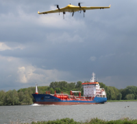
LVNL, ANWB, Altitude Angel and KPN establish digital corridor for medical delivery in the Netherlands
A collaboration between LVNL (Air Traffic Control the Netherlands), ANWB and KPN aims to establish a ‘digital corridor’ to enable medical drone flights between two
Read more