


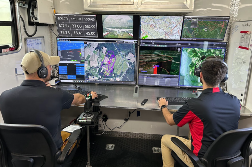
Kongsberg Geospatial has deployed its IRIS Terminal at the University of Maryland’s (UMD) UAS Research and Operations Center (UROC). The capability will initially be used to support the delivery of medical supplies across the Chesapeake Bay to Smith Island, enabling safe and scalable beyond visual line of sight BVLOS operations in partnership with UMD’s leadership in uncrewed aviation research, rulemaking and national airspace integration.
“IRIS Terminal provides real-time, map-centric situational awareness by fusing ownship telemetry and multiple cooperative and non-cooperative surveillance feeds into a single operating picture,” said Kongsberg Geospatial on September 4. “At UMDUROC, the deployment integrates ownship telemetry via MAVLink with Echodyne EchoGuard and EchoShield radars, MatrixSpace radars and PingStation ADS-B receivers to enhance airspace visibility and operational safety for the Smith Island medical logistics corridor.”
The Smith Island route connects Crisfield, Maryland with Smith Island, a community where access to care is frequently challenged by weather and transportation constraints. With multi-sensor fusion, configurable geofences, alerting and audit-ready data logging, IRIS Terminal provides UROC’s flight operations with the airspace awareness and operational tooling needed to safely plan and conduct complex missions.
The medical drone delivery programme for Smith Island is supported by State of Maryland funding that was announced in late 2024.
For more information