The Federal Aviation Administration (FAA) has issued a broad area waiver to Phoenix Air Unmanned (PAU) authorizing utility powerline inspection flights beyond the visual line of sight (BVLOS) of the remote pilot in command. The authorization spans powerline infrastructure across the United States and builds upon thousands of miles of BVLOS transmission line inspection flight experience.
PAU has partnered with key industry providers, including Freefly Systems and Kongsberg Geospatial, for delivery of its complex nationwide BVLOS solution which requires multiple layers of safety and airspace deconfliction, says the press release.
PAU has been granted operations beyond visual line of sight of the remote pilot in command and visual observers, operations over people, and operations over moving vehicles. The waiver itself relies on a robust safety case to include electronic airspace surveillance, a clear and defined operating area, and performance criteria justifying the safety of the operation.
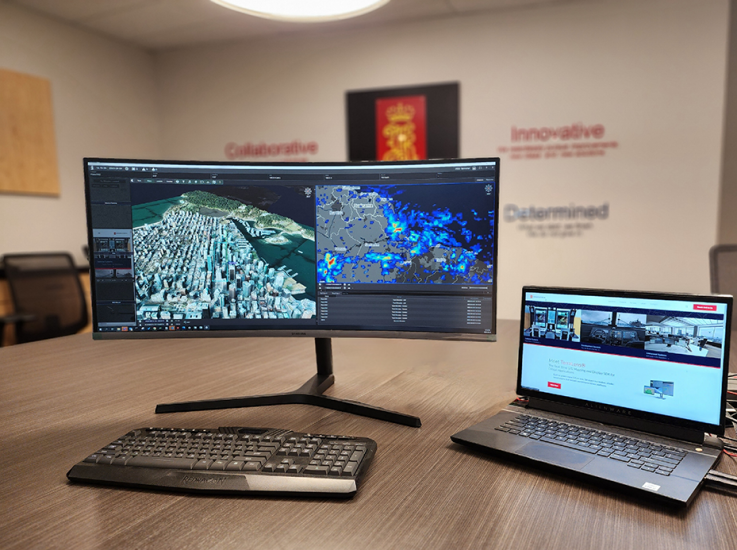
“Many issued BVLOS waivers require visual observers through the route of flight – adding cost and complexity. This authorization lists electronic airspace surveillance as an alternative risk mitigation. To build the operation we selected key partners with a track record of reliability and aviation experience. For electronic airspace surveillance PAU relies on IRIS Terminal, developed by Kongsberg Geospatial. IRIS Terminal provides our UAS operators with real-time BVLOS airspace visibility, by showing ownship tracks and cooperative and non-cooperative aircraft tracks all on the same pane of glass, located inside our mobile monitoring stations”, says William Wheeler, Director of Operations for PAU.
Phoenix Air Unmanned flight crews operate the Freefly Alta Xover the centerline of the transmission line, flying from structure to structure and capturing multiple datasets including high-resolution inspection imagery. In June of 2021, a single PAU flight team captured 134.4 miles of transmission line inspection imagery in a single day. These inspections were flown under an identical BVLOS waiver, proving the scalability of BVLOS transmission line inspection flights with UAS.
For more information visit: