Naviair and the Danish Transport, Construction and Housing Authority have launched the “Droneluftrum” “safe-fly” app for drone pilots. The website for the new app is www.droneluftrum.dk and the core data has been supplied by Belgian software company Unifly.
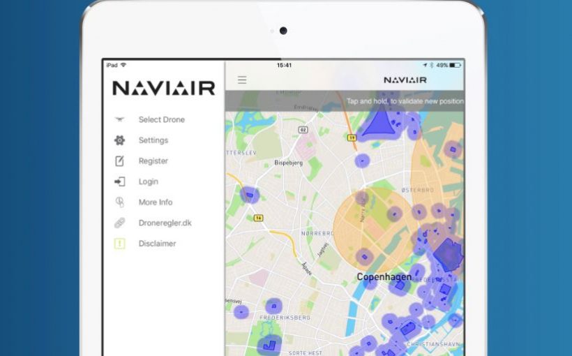
The map that shows the areas where drones can be safely and legally flown and areas where the use of drones is restricted or prohibited. Such areas and facilities include airports and other protected airspaces, hospitals, industrial and energy facilities, police and military premises, waterways, motorways, railway lines and nature reserves. The site also lists the rules, regulations and restrictions that apply to drones in Denmark.
“Our goal is to safely integrate drones into the existing air traffic system. With this app we aim to increase the level of safety in uncontrolled airspace and make it easier for the drone pilots to determine where they can operate without posing a threat to manned aviation. Droneluftrum will make it safer to use drones in the future.”, says Bo Pedersen, Director of Communications and Public Affairs, Naviair.
“We are extremely proud to have been selected by Naviair to provide the Danish drone users with a practical way to get relevant and correct, up-to-date information about where they can fly their drones,” said the CEO of Unifly, Marc Kegelaers. “Unifly seeks to improve aviation safety. We make it possible to integrate drone traffic into the airspace safely. One key element in this is to provide drone users with exact, up-to-date information about where they can fly. We take into account not only the aviation regulations, but also issues like security and privacy. With the Droneluftrum application, the complex aviation rules and regulations as well as temporary limitations are translated to a user-friendly and practical format.”