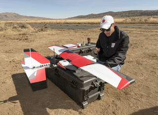
UAS operators use different ways of measuring the altitude of their vehicles above ground and many platforms do not operate reliably at the upper flight levels of their advertised capabilities. These are two major results of NASA’s Technical Capability Level 2 flight trials at Reno Stead airport, according to Dr Marcus Johnson, Research Aerospace Engineer, Aviation Systems Division, NASA Ames Research Center, speaking at the Commercial UAV Show in London.
NASA tested two beyond-visual-line-of-sight (BVLOS) and three line-of-sight drone operations at the test site close to each other, a mile to the north of the operational airport.
“We used 11 different platforms and found that operators measured altitude differently – some using the height of the drone from take-off location, others altitude above terrain while some operators followed the protocols used by manned aviation – altitude above mean sea level (MSL),” said Marcus Johnson. “The airport is 5,000ft above sea level and we found that many vehicles weren’t tested to this height even though they had been certified to 10,000ft.”
Another conclusion was that operations were vulnerable to unpredictable weather events, with the test area containing many different micro climates