AirMap and Kespry have announced a partnership that brings AirMap’s airspace intelligence, including airspace advisories, wind, and weather, to Kespry’s automated UAV drone operations.
Kespry manufactures the autonomous Kespry drone, part of an end-to-end flight planning and data analytics platform that provides customers in mining, construction, insurance, and other industries with actionable business insights. The Kespry drone can take off, gather high-resolution aerial data, avoid obstacles, and land without the help of a human pilot, helping industry customers scale their operations easily and efficiently.
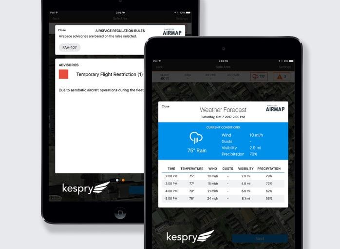
The new AirMap-Kespry integration brings AirMap’s airspace intelligence to the Kespry flight app. During the flight planning process, the app automatically surfaces AirMap airspace advisories, wind, and weather tailored to the unique parameters of each flight, including the drone operator’s pilot certification. Preflight checks are easier than ever before, autofilling this information in each mission plan to help operators move more quickly from field, to flight, to finish. Airspace rules, temporary flight restrictions, and the locations of schools, prisons, hospitals, power plants, and more can be viewed with just a tap.
According to a press statement: “Kespry is the first in the drone industry to integrate airspace intelligence from AirMap’s contextual airspace offering, which tailors rules and conditions to the exact specifications of each mission, including operator certification, flight location, and speed, height, and weight requirements. Contextual airspace features are currently available to users of AirMap’s web and mobile apps, and will be released to the entire AirMap community via a contextual airspace API in 2018.”